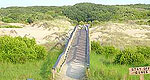
In addition to miles of sand fringed with beach grass and cooled by salt breezes, Cumberland Island National Seashore is the spot to star-gaze, hike meandering trails, bird-watch and catch cultural sights, all within easy reach of the Landmark Historic District of Jekyll Island, to the north.
Trail descends along a ridge from Brasstown Bald parking lot to Track Rock Gap. There are ups and downs, some steep along the way. The final mile has several switchbacks. Open ridge tops provide excellent views. This trail is within the Brasstown Wilderness for about 5 miles of its length. This trail is not blazed.
Details
Length:
5.5 miles
Difficulty:
Intermediate
Time:
1.5 - 2.5 hours
Additional Details:
NOTE: There is a parking fee. The trail leaves the parking lot from the northwest corner near the restrooms. To reach the lower end of the trail at Track Rock Gap, go east of Blairsville on U.S. 76 for 6 miles. Turn right (south) on Track Rock Road and drive 3 miles to a gravel parking lot
on the right just past the petroglyphs in the gap. The trail begins across the road from the parking lot.
We offer a compact version of Go-Georgia for mobile users, allowing you to access just the information you need on the road. Of course, you can still use the full version of Go-Georgia on your mobile device just as you can on your desktop.